
Plot for serious investment intentions


кв. Шаваро, Studena, region Pernik
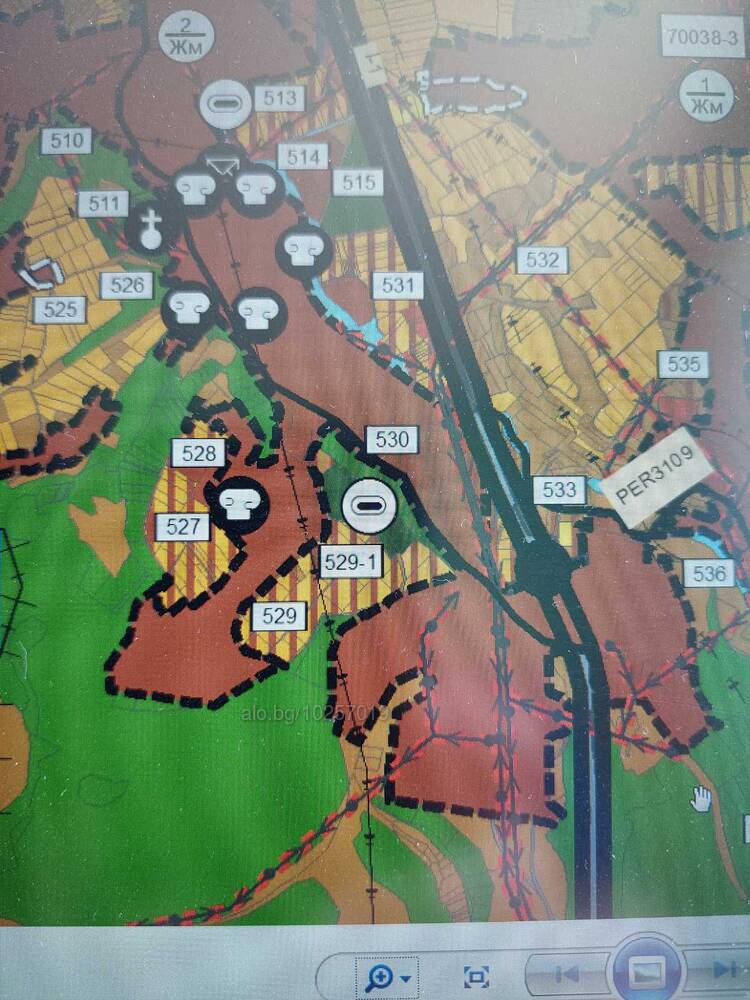
The property is the pentagonal figure outlined in white in the attached first photo. The Municipality of Pernik has developed a master plan (second photo) for the neighborhood and is in an advanced stage of developing a cadastral map not only for the neighborhood, but also for the entire village. The blue arrow in the third photo shows where the plot is located - the gray field defines the contours of the neighborhood. There is a substation 50 m. from the eastern border of the plot. A water supply line has been laid there and the street has been outlined. There are two walnut trees and low-stemmed bushes on the area. There is a possibility of bringing out your own water source. The property has separate development rights for six smaller plots, which are not divided between the other co-owners due to the common desire to sell it. An agreement is also possible for the sale of ideal parts.
The plot is located between the Struma highway and the old road to the Rila Monastery and access to it is possible from both sides.